Vacanze al Lago di Molveno, Dolomiti di Brenta

| RIFUGIO LA MONTANARA, BRENTA DOLOMITES, TRENTINO: Excursions starting and finishing at the Montanara Refuge |
| Circular tours from the La Montanara Refuge : tour of the Lasteri Gallino group | |||||
Difficulty: The odd slippery stretch at the Lasteri pass, not difficult |
maximum height :m.2286, Passo dei Lasteri |
||||
|
difference in height:metri 1040 circa |
|||||
Comment: Tiring itinerary over a route with wonderful views. The climb up to the Croz Altissimo is not very clearly marked, especially in the event of bad visibility |
|||||
| area | path | height | time between areas | time from start | notes, route variations |
| Rifugio Montanara | 352 b | 1525 | 0 | 0 | MAP |
| fork 344 b | 344b | 1840* | 1,15 | 1,15 | turn to the left |
| Passo dei Lasteri | 344b | 2281 | 1,25 | 2,40 | - |
| Passo del Clamer | 344 | 2164 | 0,35 | 3,15 | - |
| Malga Spora | 301 | 1851 | 0,50 | 4,05 | go eastwards |
| fork 301-353 | 353 | 1850* | 0,15 | 4,20 | turn rightwards |
| Passo Dagnola | 353 | 2135 | 0,50 | 5,10 | - |
| fork 353-352,Tovo Valon | 352 | 1960 | 0,25 | 5,35 | turn rightwards |
| Albi del Mont, fork 352 e mulattiera | mulat | 1500* | 1,00 | 6,35 | turn
right, i.e. westwards, onto the mule-track to the Montanara Refuge and
where it joins the ski run climb towards the right |
| Rifugio Montanara | - | 1525 | 0,15 | 6,50 | - |
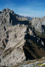
Passo Clamer da pendici Lasteri con Cima Gaiarda , Cima Vallazza, Cima Roma e Croz dei Mandrin
| Circular tours from the La Montanara Refuge: Tour of the Lasteri Gallino – Croz Altissimo Group | |||||
Difficulty: tiring, not difficult |
maximum height :m. 2164 , Passo del Clamer |
||||
|
difference in height: 1120 metri |
|||||
Comment: tour of the Altissimo Gallino group. 360° views along little used routes, except for the Croz Altissimo Refuge – Pradel – Montanara stretch |
|||||
| area | path | height | time between areas | time from start | notes, route variations |
| Rifugio Montanara | 352 b | 1525 | 0 | 0 | MAP |
| fork 344 b | 352b | 1840* | 1,15 | 1,15 | turn right |
| Coei, fork 352 | 352 | 1830* | 0,30 | 1,45 | - |
| Bivio 353-352,Tovo Vallon | 353 | 1960 | 0,25 | 2,10 | turn left |
| Passo Dagnola | 353 | 2135 | 0,35 | 2,45 | - |
| fork 301-353 | 301 | 1850* | 0,40 | 3,25 | turn left |
| Malga Spora | 301 | 1851 | 0,15 | 3,40 | - |
| Passo Clamer, fork 344,344b | 344 | 2164 | 1,00 | 4,40 | - |
| Vallazza, fork 322, 344 | 322 | 1600 | 1,10 | 5,50 | turn left |
| Rifugio Croz Altissimo | 340 | 1430 | 0,30 | 6,20 | - |
| Seghe del Marillon, fork 340b | 340b | 1330 | 0,30 | 6,50 | turn
left for the Grotte path |
| Rifugio Montanara | 352 b | 1525 | 0,40 | 7,30 | - |
Discesa dal Passo Dagnola lungo il s.352 con panorama sul Lago di Molveno
| Circular tours from the La Montanara Refuge: tour of the Gradeccia. | |||||
|
Difficulty: easy |
maximum height :m.1870 circa |
||||
|
difference in height: 340 metri circa |
|||||
Comment: Enjoyable south-facing excursion which crosses the slopes of the Altissimo-Lasteri-Gallino group from west to east |
|||||
| area | path | height | time between areas | time from start | notes, route variations |
| Rifugio Montanara | 352 b | 1525 | 0 | 0 | MAP |
| fork 344 b | 352b | 1840* | 1,15 | 1,15 | turn right |
| Coei, fork 352 | 352 | 1830* | 0,30 | 1,45 | - |
| Albi del Mont, fork 352 e mulattiera | mulat | 1500* | 1,00 | 2,45 | turn
right, i.e. westwards, onto the mule-track to the Montanara Refuge and
where it joins the ski run climb towards the right |
| Rifugio Montanara | - | 1525 | 0,15 | 3,00 | |
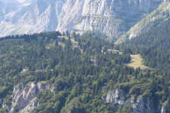
Altipiano di Pradel e Malga Tovre
| Circular tours from the La Montanara Refuge: Tour of the Altopiano di Pradel tableland. Grotte path, path no. 340, path no. 352, Albi del Mont, Malga Tovre. | |||||
Difficulty: Easy with the odd steep stretch on the Grotte path |
maximum height :m. 1525 ,Rif. Montanara |
||||
|
difference in height: metri 320 |
|||||
Comment: Easy itinerary in the heart of the Pradel woods |
|||||
| area | path | height | time between areas | time from start | notes, route variations |
| Rifugio Montanara | 352 b | 1525 | 0 | 0 | MAP |
| Seghe del Marillon, fork 340b | 340b | 1330 | 0,30 | 0,30 | turn left |
| Rifugi di Pradel | strada per Andalo | 1320 | 0,20 | 0,50 | continue
eastwards along an unmetalled road for Andalo |
| bar Pineta | strada | 1300 | 0,25 | 1,15 | turn right |
| fork 352 | 352 | 1200 | 0,15 | 1,30 | turn left |
| Albi del Mont | mulattiera | 1500* | 0,35 | 2,05 | turn left, i.e. westwards, onto the mule-track |
| Malga Tovre | pista sci | 1460 | 0,20 | 2,25 | climb up the ski slope to the refuge |
| Rifugio Montanara | 352 b | 1525 | 0,20 | 2,45 | - |
Visualizza Parco Adamello Brenta, Settore Brenta in una mappa


