Vacanze al Lago di Molveno, Dolomiti di Brenta

|
|
|
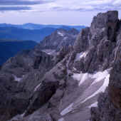
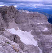
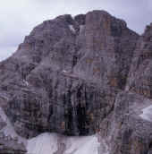
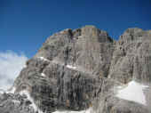
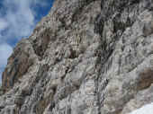
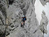
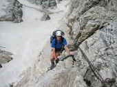
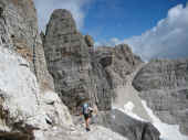
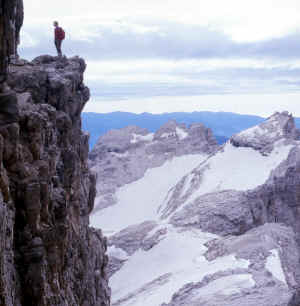
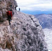
The routes with fixed rope supports in the Brenta Dolomites, Trentino: Sentiero Benini This is the continuation northwards of the Bocchette Alte way. It links the Bocca del Tuckett pass, accessible from the Tuckett Refuge, with path no. 303. At the Bocca del Tuckett pass you begin the ascent, by means of ladders and ropes, of the south-west rock face of the Cima Sella peak (to the left of the Bocca looking southwards). After a first terrace you begin to climb towards the Bocca Alta di Vallesinella (2,875 m.). Then, after passing the Campanile di Vallesinella peak from the east, you begin to go along the ledge, still from the east, of the Cima Falkner peak which is the highest point of the route (2,910 m.). The ledge, with fixed rope supports, takes you past the side of the Cima Falkner to the Campanile and you carry on as far as the pass of the same name (2,740 m.). In the last stretch of the Benini route you cross the Cima Grostè slope and then go down some rock steps to the pass and then to the refuge. |
| Starting point: | Rifugio Tuckett |
| Finishing point: | rifugio Stoppani al Grostè |
| Maximum height: | mt 2910, near cima Falkner |
| Difference in height: | mt 700 circa |
| Time required: | 4 hours from Tuckett Refuge, 3 hours from the Bocca del Tuckett |
| Main peaks crossed: | Cima Sella, Campanile di Vallesinella, Cima Falkner, Campanile dei Camosci, Cima Grostè. |
| number of path: | 303 till the Bocca del Tuckett, 305. |
| Recommended route for early return to base: | From the upper Vallesinella hanging glacier you can reach the Tuckett Refuge along the Dallagiacoma path (no. 315) in about an hour. |
| Level of difficulty: | Middling difficulty |
| Period recommended: | JUNE - SEPTEMBER |
| Special remarks: | - |
 |
 |
| Sentiero Benini con Cima Roma e Cima Vallazza. Foto M.Comper | Sentiero Benini c Foto M.Comper |
 |
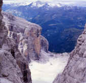 |
| Sentiero Benini. Foto M.Comper | Castello di Vallesinella e Vedretta. Foto M.Comper |
Table of times between points and heights: sentiero Alfredo Benini
| area | path | height | time between areas | time from start | notes, route variations |
| Rifugio Tuckett | 303 | 2270 | 0 | 0 | - |
| Bocca di Tuckett,fork 303,305 | 305sx | 2648 | 1,10 | 1,10 | take the left, eastwards |
| Cresta n.o. di Cima Sella, fork 315 | 305 | 2750* | 0,30 | 1,40 | - |
| Fianco sud Est Cima Falkner | 305 | 2910 | 0,40 | 2,20 | - |
| Bocca dei Camosci | 305 | 2771 | 0,40 | 3,00 | - |
| Passo del Grosté | - | 2442 | 1,20 | 4,20 | - |


