Lago Park Hotel Molveno in riva al lago di fronte alle  Dolomiti di Brenta

Vacanze al Lago di Molveno, Dolomiti di Brenta

Home
info
Natural Park
the valleys
refuges
refuges connections
circular tours
route fixed rope
crossing routes
hiking
towns
Trentino hotels
tours by car
gallery


  e-mail  


meteo

up ] The Bocchette Alte way ] [ The  Bocchette Centrali way ] sentiero Benini ] sentiero Brentari ] Sentiero Castiglioni ] Sentiero Oliva Detassis ] sentiero Sosat ] sentiero G.Vidi ]

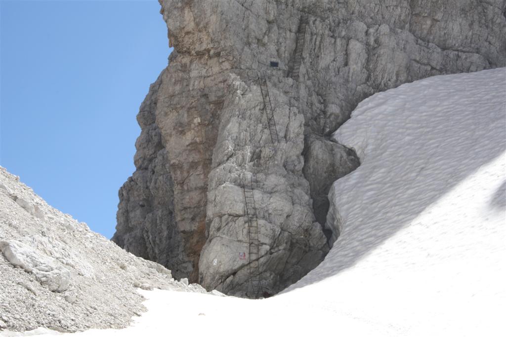
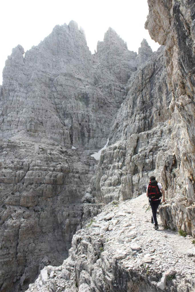
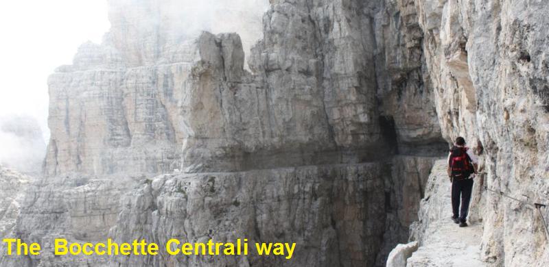
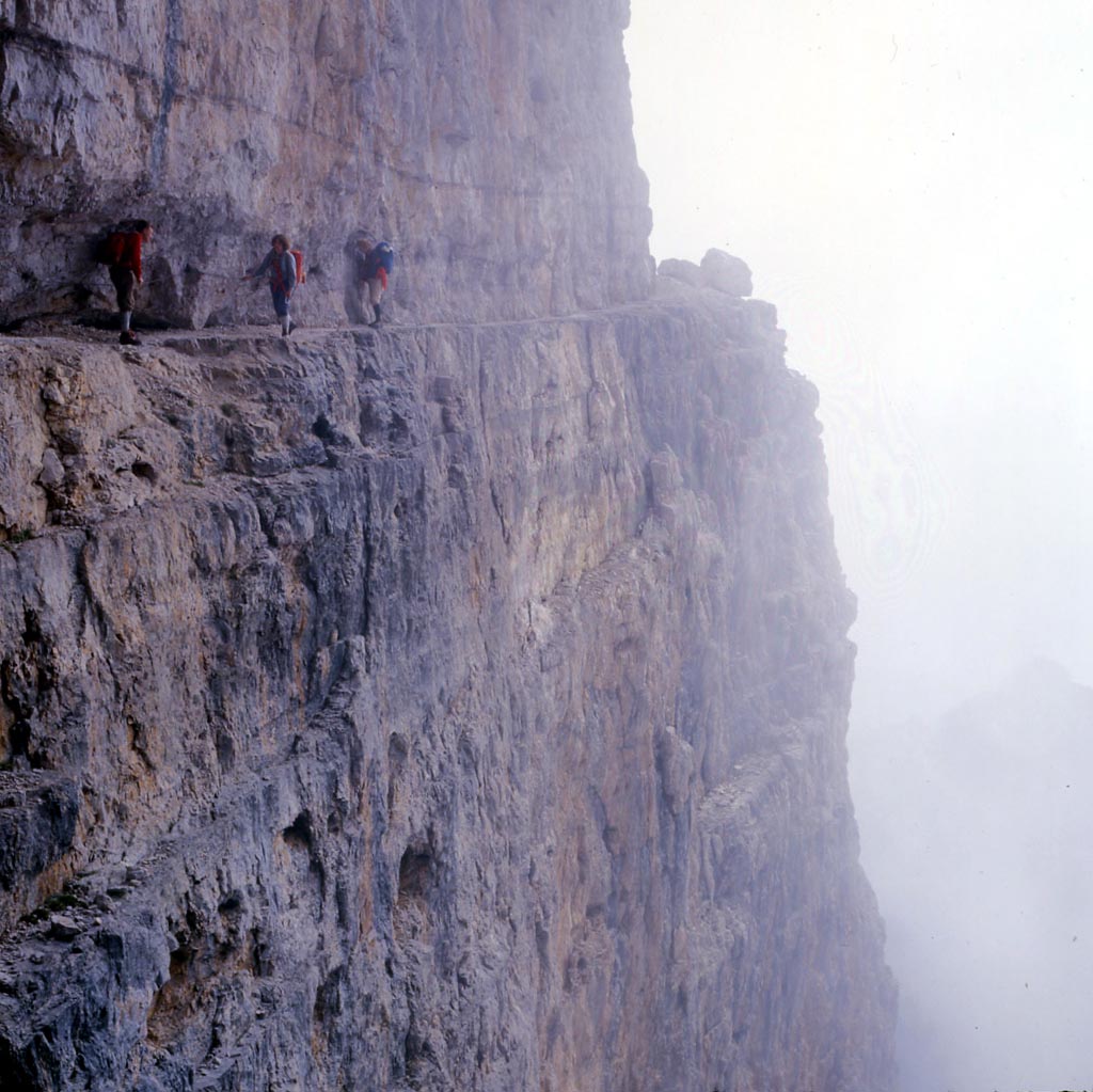
The  Bocchette Centrali way, Brenta Dolomites, Trentino

Description:The SAT (Trentino Mountain-Climbing Association) started work on this route in 1936. The various stretches were dedicated to well-deserving SAT members or to those financing the work. The particular beauty of the scenery, the audacity of the routes and the unmistakable majesty of the shapes of the Dolomite pinnacles are the reasons for the fame of this Alpine itinerary, and a large number of enthusiasts have been able to appreciate this route for themselves. Unfortunately not all hikers show proper respect for the environment (certain natural cavities in the Brenta gorges are full of unpleasant reminders of the passage of hordes of “forgetful” tourists). The first stretch of the route, dedicated to Otto Gottstein, starts just after the Bocca di Brenta pass. A series of ladders takes you around the Cima Brenta Alta from the west, going along a natural rock ledge which leads to the Bocchetta del Campanil Basso (2,620 m.). This is the beginning of the stretch dedicated to Arturo Castelli which goes to the Bocchetta Bassa degli Sfulmini pass. Then the route climbs up the slopes of the Campanil Basso as far as the Bocchetta del Campanile Alto and the Sentinella plain, and from here it goes along the ledge to the Bocchetta Bassa degli Sfulmini pass. This is the start of the stretch dedicated to Carla Benini de Stanchina. You then go past the Torri degli Sfulmini along a ledge carved out of the rock, keeping to the eastern slope, until you arrive at the Bocchetta Alta degli Sfulmini pass where the Figari route begins, Go around the Torre di Brenta from the south-east, on terracings carved out of the rock and you come to the distinctive tooth which overlooks the Bocca Armi pass, reached by means of a series of metal ladders. In about 30 minutes, after going down the Armi hanging glacier, you come to the Alimonta Refuge. Hikers often feel a sense of melancholy mixed with satisfaction at the end of this route, for the experience of the hike and for the unforgettable scenery the route offers.  

Sentiero delle Bocchette Centrali, Dolomiti di Brenta, passaggio sperone Torre di Brenta Sentiero delle Bocchette Centrali, Dolomiti di Brenta, tra le nubi il Monte Daino Sentiero delle Bocchette Centrali, Dolomiti di Brenta, passaggio nei pressi di Bocca Armi inizio Sentiero delle Bocchette Centrali, Dolomiti di Brenta,sullo sfondo  la Presanella Sentiero delle Bocchette Centrali, Dolomiti di Brenta,.
Sentiero delle Bocchette Centrali, Dolomiti di Brenta. Sentiero delle Bocchette Centrali, Dolomiti di Brenta. Sentiero delle Bocchette Centrali, Dolomiti di Brenta, passaggio angusto tra le rocce Sentiero delle Bocchette Centrali, Dolomiti di Brenta, passaggio lungo la Brenta Alta
Starting point: rifugio  Tommaso Pedrotti , mt 2491
Finishing point: Rifugio Alimonta , mt 2580
Maximum height: 2,770 metres, eastern edge of the Torre di Brenta
Difference in height: 300 metri circa
Time required: 3,30 hours
Rest points and bars along the way: none
Path numbers: 318,305
Recommended route for early return to base: from the Bocchetta del Campanile Basso over the slippery scree and following traces of a path you come to path no. 303 (Orsi path) and from here path no. 319 which goes to the Pedrotti Refuge. There is an alternative but more demanding route that comes down from the Bocca Armi pass towards the east (Massodi Valley).
Level of difficulty: of middling difficulty but quite exposed
Period recommended: mid-June to September
Main peaks crossed: Brenta Alta, Campanil Basso, Campanile Alto, Torre degli Sfulmini, Torre di Brenta
Special remarks: -

Passaggio scavato nella roccia sullo spigolo della Torre di brenta

Via delle Bocchette, Gruppo di Brenta

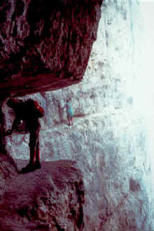
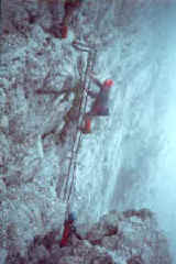
Table of times between points and heights  Bocchette Centrali Way

area path height time between areas time from start notes, route variations
rifugio  Tommaso Pedrotti i 318 2491 0 0 car_Bocchette_centrali_r.jpg (389363 byte)
Bocca di Brenta, fork 305  305 2552 0,10 0,10
Bocc. del Campanil Basso 305 2620 1,00 1,10
Bocca dei Armi 323 2749 2,00 3,10 -
Rifugio Alimonta 323 2580 0,30 3,40 -

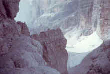
Other Pictures of the Bocchette Centrali 

Rifugio_Alimonta_e Vedretta_Armi.JPG (146097 byte)
Rifugio Alimonta e Vedretta Armi
Dente_Bocca_Armi.JPG (93958 byte)
Il Dente presso Bocca Armi, fine ferrata
Rifugio_Pedrotti..JPG (83183 byte)
Rifugio Pedrotti, base di partenza da sud per le Bocchette Centrali


Le_torri_degli_Sfulmini.JPG (95745 byte)
Le Torri degli Sfulmini
Torri_Sfulmini-2.JPG (105098 byte)
La salita della parete  della Torre di Brenta
IMG_0452_Large.JPG (160907 byte)
Lungo il sentiero  nella traversata della Torre di Brenta
Via_Bocchette_Centrali_4.JPG (120085 byte)
Bocchette centrali, panorama verso sud est
La_sentinella.JPG (89828 byte)
La Sentinella
Bocchette_Centrali_5.JPG (169527 byte)
Bocchette_Centrali_6.JPG (90532 byte) Bocchette_Centrali_3.JPG (62336 byte) Spigolo_ne_Torre_Brenta.JPG (68570 byte)
Lungo lo spigolo nord est della Torre Brenta
Via_delle_Bocchette_Centrali.JPG (106823 byte)
Il celebre camminamento tra il Campanile Alto e la Torre
Brenta_alta.JPG (109776 byte)
Brenta Alta e tra le nebbie il Campanil Bass dalla via delle Bocchette
Spigolo_sud_Torre.JPG (100174 byte)
Il Monte Daino dallo Spigolom sud della Torre di Brenta