Vacanze al Lago di Molveno, Dolomiti di Brenta

|
LA MONTANARA REFUGE, BRENTA DOLOMITES, TRENTINO: Connections with other refuges |
| Connections with other refuges: To the Croz Altissimo Refuge along the Grotte path | |||||
Difficulty: Easy, the odd exposed stretch |
maximum height : m.1525 , Rif. Montanara |
||||
difference in height:110 metri |
|||||
Commento: wonderful itinerary |
|||||
| area | path | height | time between areas | time from start | notes, route variations |
| Rifugio la Montanara | 340b | 1525 | 0 | 0 | MAP |
| Seghe del Marillon, fork 340b | 340 | 1330 | 0,30 | 0,30 | take the right |
| Rifugio Croz Altissimo | 340 | 1430 | 0,35 | 1,05 | - |
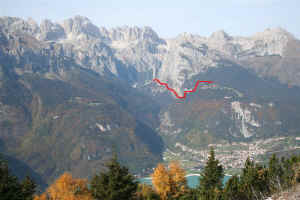
Itinerario Rifugio Montanara Sentiero delle Grotte Rifugio Croz Altissimo
| Connections with other refuges: to Croz Altissimo Refuge via the Lasteri Pass, paths 352b, 344b and 344 | |||||
|
Difficulty: Difficult in parts, tiring. |
maximum height : m.2281, Passo Lasteri |
||||
|
difference in height: metri 760 circa |
|||||
Comment: An alternative route for those who have climbed the Croz Altissimo peak |
|||||
| area | path | height | time between areas | time from start | notes, route variations |
| Rifugio la Montanara | 352 b | 1525 | 0 | 0 | MAP |
| fork 344 b | 344b | 1840* | 1,15 | 1,15 | turn to the left |
| Passo dei Lasteri | 344b | 2281 | 1,25 | 2,40 | - |
| Passo del Clamer | 344 | 2164 | 0,35 | 3,15 | take the right |
| Vallazza, fork 322, 344 | 322 | 1600 | 1,10 | 4,25 | turn to the left |
| Rifugio Croz Altissimo | 340 | 1430 | 0,30 | 4,55 | - |
Itinerario Rifugio Montanara Passo Lasteri Passo Clamer Rifugio Croz Altissimo
| Connections with other refuges: To the Malga Spora via the Dagnola Pass, paths 352b, 352, 353 and 301 | |||||
Difficulty: not difficult |
maximum height : m.2145,Passo Dagnola |
||||
|
difference in height: 610 metri |
|||||
Comment: Little used path but well marked |
|||||
| area | path | height | time between areas | time from start | notes, route variations |
| Rifugio la Montanara | 352 b | 1525 | 0 | 0 | MAP |
| fork 344 b | 352b | 1840* | 1,15 | 1,15 | turn to the right |
| Coei, fork 352 | 352 | 1830* | 0,30 | 1,45 | - |
| fork 353-352,Tovo Vallon | 353 | 1960 | 0,25 | 2,10 | turn to the left |
| Passo Dagnola | 353 | 2135 | 0,35 | 2,45 | - |
| fork 301-353 | 301 | 1850* | 0,40 | 3,25 | turn to the left |
| Malga Spora | 301 | 1851 | 0,15 | 3,40 | - |
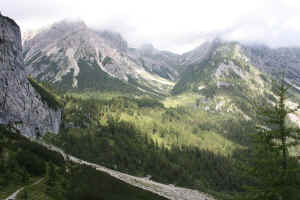
Campo Spora e Val dei Cavai dal sentiero 353 per Passo Dagnola
| Connections with other refuges: To Lake Tóvel or other areas in the Campa Group via the Dagnola Pass and the Cavai Valley | |||||
|
Difficulty: Long and tiring, not difficult |
maximum height : m. 2376, Passo di Val Scura |
||||
|
difference in height: m.1300 |
|||||
Comment: Long and interesting itinerary along little used but well marked routes. Recommended for fit hikers. |
|||||
| area | path | height | time between areas | time from start | notes, route variations |
| Rifugio la Montanara | 352 b | 1525 | 0 | 0 | - |
| fork 344 b | 352b | 1840* | 1,15 | 1,15 | turn to the right |
| Coei, fork 352 | 352 | 1830* | 0,30 | 1,45 | - |
| fork 353-352,Tovo Vallon | 353 | 1960 | 0,25 | 2,10 | turn to the left |
| Passo Dagnola | 353 | 2135 | 0,35 | 2,45 | - |
| fork 301-353 | 301 | 1850* | 0,40 | 3,25 | turn to the left |
| Sella del Montoz | 338 | 2327 | 1,30 | 4,55 | - |
| Alpe Campa, fork 369-338 | 369 | 2200* | 0,15 | 5,10 | - |
| Passo di Val Scura | 369 | 2376 | 0,35 | 5,45 | MAP Molverno Passo Gaiarda |
| Ponte Rio Tresenica | 314 | 1560 | 2,10 | 7,55 | |
| Lago di Tovel | 314 | 1189 | 1,00 | 8,55 | MAP Passo Gaiarda Tovel |
Visualizza Parco Adamello Brenta, Settore Brenta in una mappa


