Vacanze al Lago di Molveno, Dolomiti di Brenta

| RIFUGIO CROZ ALTISSIMO, BRENTA DOLOMITES, TRENTINO: Excursions starting and finishing at the Croz Altissimo Refuge |
| Circular tours: tour of the Lasteri-Gallino group | |||||
Difficulty: tiring, not difficult |
maximum height : m 2164 Passo Clamer |
||||
|
difference in height :m m.1020 circa |
|||||
Comment: this is quite a tiring itinerary thanks to the difference in height, but is rewarding for the wonderful scenery and views it offers of the Brenta Group near the Clamer and Dagnola passes. Little used, the route has the odd difficult stretch near the Clamer Pass. |
|||||
| area | path | height | time between areas | time from start | notes, route variations |
| Rifugio Croz Altissimo | 322 | 1430 | 0 | 0 | MAP |
| Vallazza, fork 322, 344 | 344 | 1600 | 0,30 | 0,30 | turn rightwards |
| Passo Clamer, fork 344,344b | 344 | 2164 | 1,30 | 2,00 | - |
| Malga Spora | 301 | 1851 | 0,45 | 2,45 | turn rightwards |
| fork 301-353 | 353 | 1850* | 0,15 | 3,00 | - |
| Passo Dagnola | 353 | 2135 | 0,50 | 3,50 | - |
| fork 353-352,Tovo Valon | 352 | 1960 | 0,25 | 4,15 | - |
| Albi del Mont, fork 352 e mulattiera | mulat | 1500 | 1,00 | 5,15 | turn rightwards |
| Malga Tovre | ski slope | 1460 | 0,20 | 5,35 | - |
| Alberghi di Pradel | 340 | 1320 | 0,10 | 5,45 | - |
| Rifugio Croz Altissimo | - | 1430 | 0,50 | 6,35 | - |
| Circular tours from the Croz Altissimo Refuge: tour of the Cima Gaiarda and the Crozzon dei Mandrini | |||||
Difficulty: tiring, not difficult |
maximum height : mt 2443, Bocca Vallazza |
||||
|
difference in height: |
|||||
Comment: An unusual itinerary and off the beaten track. It climbs up to the Clamer and Gaiarda passes, crosses the southern ridge of the Turrion Alto and goes down from the Bocca Vallazza in the Perse Valley. |
|||||
| area | path | height | time between areas | time from start | notes, route variations |
| Rifugio Croz Altissimo | 322 | 1430 | 0 | 0 | MAP |
| Vallazza, fork 322, 344 | 344 | 1600 | 0,30 | 0,30 | turn rightwards |
| Passo Clamer, fork 344,344b | 344 | 2164 | 1,30 | 2,00 | |
| Malga Spora | 301 | 1851 | 0,45 | 2,45 | - |
| Passo Gaiarda | 301 | 2242 | 1,10 | 3,55 | - |
| Campo Flavona, fork 301,Bocca Vallazza | ramo 314 | 2200* | 0,10 | 4,05 | take leftwars (south), not marked path |
| Bocca Vallazza | 314 | 2443 | 1,00 | 5,05 | - |
| Busa dell'Acqua, fork 322 | 322 | 1920* | 1,10 | 6,15 | |
| Rifugio Croz Altissimo | - | 1430 | 1,10 | 7,25 | - |
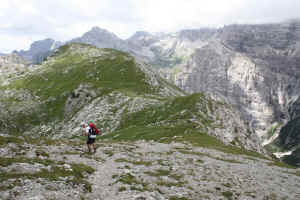
La salita al Passo dei Mandrini da Campo Flavona: sullo sfondo il Mular Basso.
| Circular tours from the Croz Altissimo Refuge : From the Clamer Pass to the Lasteri Pass and Montanara Refuge, tour of the Croz Altissimo | |||||
Difficulty: tiring, not difficult |
maximum height : m.2286, Passo del Lasteri |
||||
|
difference in height: m. 860 |
|||||
Comment: This is quite a tiring itinerary thanks to the difference in height, but is rewarding for the wonderful scenery and views it offers of the Brenta Group near the Clamer and Dagnola passes. Little used, the route has the odd difficult stretch near the Clamer Pass. The descent from the Croz Altissimo can also be difficult in the case of bad visibility. At the top of the Lasteri pass it is well worth the detour up to the southern peak of the Croz Altissimo where a metal cross stands in memory of an unlucky mountaineer. |
|||||
| area | path | height | time between areas | time from start | notes, route variations |
| Rifugio Croz Altissimo | 322 | 1430 | 0 | 0 | MAP |
| Vallazza, fork 322, 344 | 344 | 1600 | 0,30 | 0,30 | turn rightwards |
| Passo Clamer, fork 344,344b | 344b | 2164 | 1,30 | 2,00 | turn rightwards |
| Passo del Lasteri | 344b | 2286 | 0,30 | 2,30 | |
| Albi di Mandrin, fork 352 b | 352 b | 1810* | 1,00 | 3,30 | keep the right |
| Rifugio Montanara | 340b | 1525 | 1,10 | 4,40 | |
| fork 340-340b, seghe del Mulon | 340 | 1320 | 0,30 | 5,10 | turn rightwards |
| Rifugio Croz Altissimo | 322 | 1430 | 0,30 | 5,40 | - |
Verso Cima Croz Altissimo da Passo Lasteri lungo il sentiero 344b
| Circular tours from the Croz Altissimo Refuge: Tour of the Seghe Valley. To the Selvata and Malga Andalo refuges and back along the Donini path | |||||
|
Difficulty: a short stretch has fixed rope supports |
maximum height : m.. 1630, Rifugio Selvata |
||||
|
difference in height: m.710 |
|||||
Comment: An interesting itinerary which links the two sides of the Seghe Valley |
|||||
| area | path | height | time between areas | time from start | notes, route variations |
| Rifugio Croz Altissimo | 340 | 1430 | 0 | 0 | map |
| Rifugio Selvata | 332 | 1630 | 0,40 | 0,40 | - |
| Rifugio Malga Andalo | s.Donini | 1357 | 1,00 | 1,40 | |
| LocalitÓ Pontesel | 319 | 920* | 1,00 | 2,40 | turno to the left |
| Baito Orsi | 319 | 1180* | 0,35 | 3,15 | - |
| Tabelle, fork 319-322 | 322 | 1300* | 0,25 | 3,40 | - |
| Rifugio Croz Altissimo | - | 1430 | 0,25 | 4,05 | - |
Molveno, IL Lago, Val di Ceda, Cime di ceda Malga Andalo, Monte Daino, Brenta Alta e Sfulmini
| Circular tours from the Croz Altissimo Refuge: tour of the Vallazza group, GrostŔ, Vallesinella | |||||
Difficulty: tiring, not difficult |
maximum height : m.2648 , Bocca di Tuckett |
||||
difference in height: m. 1620 |
|||||
Comment: Very long and tiring but not difficult. Only for the very fit |
|||||
| area | path | height | time between areas | time from start | notes, route variations |
| Rifugio Croz Altissimo | 322 | 1430 | 0 | 0 |  Cartina su gentile concessione Editrice la Giralpina |
| Vallazza,fork 344 | 322 | 1600* | 0,30 | 0,30 | |
| Busa dell'Acqua, fork 322,314 | 314 | 1920 | 1,00 | 1,30 | |
| Bocca della Vallazza | 314 | 2453 | 1,45 | 3,15 | |
| fork 314-301 | 301 | 2206 | 0,35 | 3,50 | turn to the left |
| Passo del GrostÚ, Rifugio Stoppani | 301 | 2442 | 0,40 | 4,30 | - |
| Rifugio Tuckett | 303 | 2270 | 1,15 | 5,45 | - |
| Bocca di Tuckett | 303 | 2648 | 1,00 | 6,45 | - |
| fork 303-322 | 303 | 2480 | 0,25 | 7,10 | - |
| busa dell'acqua, bivio 322,314 | 322 | 1920* | 1,00 | 8,10 | |
| fork 322-344,Vallazza | 322 | 1600* | 0,40 | 8,50 | |
| Rifugio Croz Altissimo | 322 | 1430 | 0,25 | 9,15 | - |
Visualizza Parco Adamello Brenta, Settore Brenta in una mappa


